
KEARNEY — Five tornadoes, some of them damaging, impacted several communities in south central Nebraska during the afternoon and evening hours of Thursday, Oct. 12.
A Slight Risk, a level two out of five, had been issued by the Storm Prediction Center for nearly all central Nebraska and extending east.
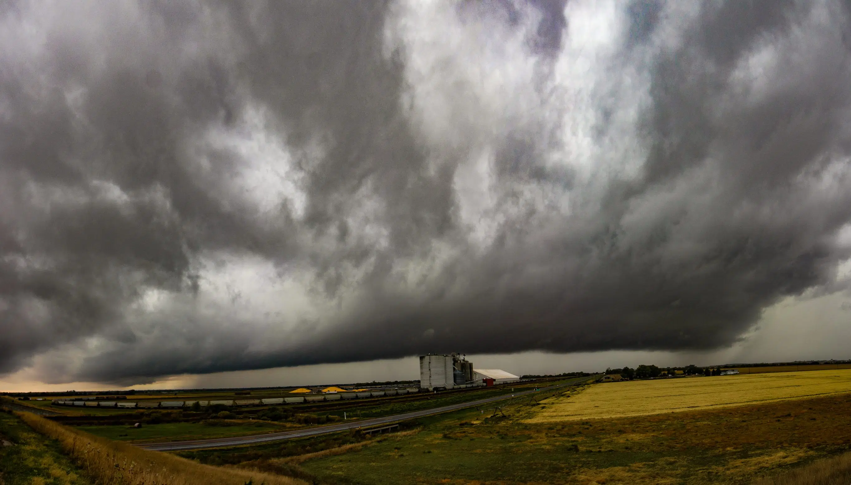
An upper-level trough ejected out into the Great Plains and induced the formation of a surface low pressure system in the Colorado-Kanas-Nebraska border area.
Michelle Schuldt, a meteorologist with National Weather Service – Hastings, said this surface low was helping to pull rich low-level moisture north.
In addition, there was higher wind shear present that would help to organize thunderstorms and possibly produce tornadoes, Schuldt said.
An attended cold front was pushing west to east and would serve as an additional forcing mechanism for storms.
Thunderstorms began to form across the area as the upper level forcing increased. Portions of the storms began to organize due to the wind shear.
One storm took on mid-level rotation in Phelps County, the storm also began rotating in the lowest levels.
The first tornado, rated EF-0, occurred northeast of Bertrand around 2:05 p.m. and 2:08 p.m. Its estimated maximum winds were 80 mph, width was 30 yards and path length totaled 1.8 miles.
“The tornado upset the end of one center irrigation pivot before rolling across cattle feed lot. At the feed lot, the tornado damaged some trees, caused minor roof damage, blew out vehicle winds and lifted the cover from a small generator shed. The tornado likely lifted northeast of the feed lot,” per NWS Hastings.
The same thunderstorm continued to move northeast and around 2:20 p.m., produced an EF-U tornado 3.5 miles south of Overton in Dawson County.
A tornado is rated EF-U (unknown) due to the lack of appreciable damage. The location of this tornado and other EF-U’s during the evening were estimated from public reports, videos, and photos.
The Overton tornado was reported by storm chasers driving on Interstate 80, according to NWS Hastings.
Storms continued to develop in south central Nebraska and the southern portion of a thunderstorm complex took on mid-level rotation.
The most damaging tornado of the evening occurred two miles southeast of Hildreth.
“This EF1 rated tornado with estimated peak winds of 90 mph was on the ground for just over six miles and for about 10 minutes,” per NWS Hastings, “Early on, the damage path was primarily found via corn stalks in fence and power lines. Eventually the tornado overturned two pivots before reaching a farmstead near Highway 10 about eight miles south of Minden.”
“Most structural damage was at the farmstead, including part of garage wall pushed from its foundation, damage to windows and trees and the top torn from a grain bin. The tornado crossed the highway and gradually dissipated,” NWS Hastings stated.
As the thunderstorm complex continued to the east, areas of mid-level rotation continued to develop.
At 4:45 p.m., an EF-0 tornado was reported just east of Prosser in Adams County. NWS Hastings noted this twister primarily impacted corn along its short path of 1.23 miles.
The same thunderstorm also produced a rope-like tornado that was rated EF-U, three miles southwest of Doniphan in Hall County.
“No rating nor wind speed was assigned due to the lack of quality damage indicators in the area,” per NWS Hastings.
An additional EF-U had a brief touchdown near Beloit, Kan., in Mitchell County at 3:39 p.m.
“This tornado was reported by the public to the NWS via pictures and video. No rating nor wind speed was assigned due to the lack of quality damage indicators in the area. The location is estimated,” NWS Hastings stated.
The NWS would like to thank local Emergency Management, spotters and others who supplied reports, pictures and videos of the various tornado events.


