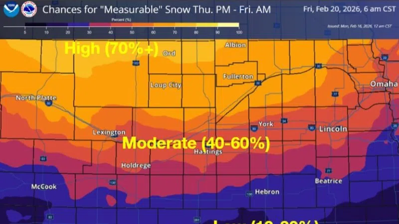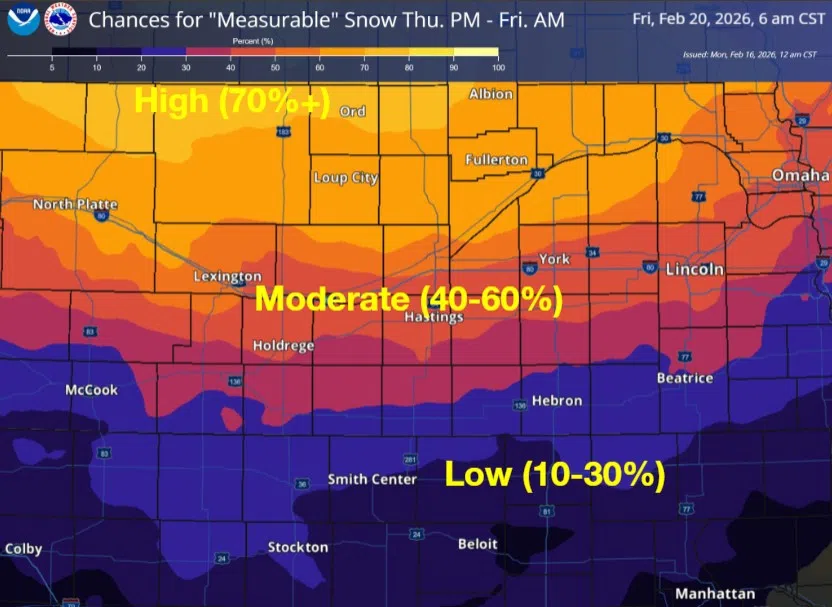
Chances for measurable snow from the evening of Thursday, Feb. 19 through the morning of Friday, Feb. 20, (NWS Hastings, Courtesy)
HASTINGS — After record high temperatures expected before midweek, a major pattern change toward colder and more active will result in snow chances Thursday night into Friday.
According to the National Weather Service – Hastings, Tuesday looks to be the warmest day of the week, practically hot, with temperatures in the upper 70s and lower 80s.
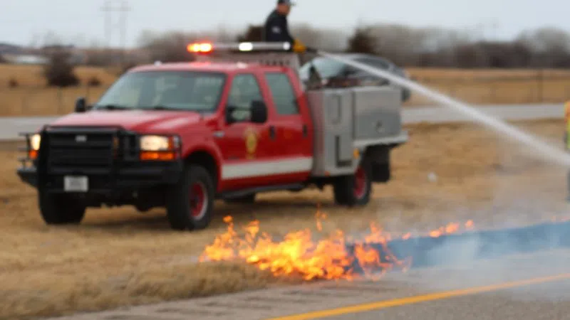
Critical fire weather conditions will be present on Tuesday across the entire area and a Fire Weather Watch will likely be upgraded to a Red Flag Warning. NWS Hastings says the fire weather could be “extreme” for areas west of Highway 281.
Wednesday will be the transition day between the warm temperatures on Tuesday and the likely return of winter on Thursday.
“Model guidance continues to indicate some potential for measurable snow, perhaps even significant snow, for portions of the forecast area Thursday into Friday morning,” NWS Hastings noted in a forecast discussion.
At this point, the Nebraska counties along and north of Interstate 80 look to be at the greatest risk of winter weather impacts.
“Amounts will depend on usual track and intensity details that are just far out to detail at this time. There does appear to be some potential for gusty winds, as well, which could enhance impacts,” per NWS Hastings.
As surface high pressure moves across the area on Thursday night, it will contribute to a cold morning on Friday, with temperatures in the single digits in the north to 10-15 degrees in the south.
Flow aloft will become more zonal on Friday into Saturday, temperatures will be more seasonable for the weekend, especially if there is snow cover. Highs look to be near average or slightly below for this time of year over the weekend.