
NEBRASKA — While drought conditions remain largely unchanged, the area is looking at a dry and hot first half of September, which could lead to future degradation.
The U.S. Drought Monitor released their weekly update on Thursday, Aug. 31 and there have been no changes across the Tri-Cities area and little change across much of the state.
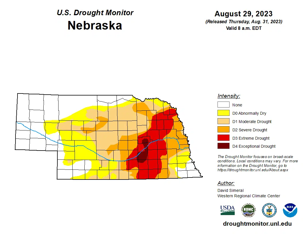
Looking at the big picture, areas with no current drought conditions only grew from 29.5 percent last week to 31.3 percent this week.
A swath of Exceptional Drought, D4, conditions are still in place across Nance, Merrick and Hamilton counties.
The majority of Hall and Adams counties and the eastern sliver of Kearney County are a part an area of Extreme Drought, D3, conditions that extends from the Nebraska-Kansas line to Dakota County in northeastern Nebraska.
Buffalo County is cut down the middle with Severe Drought, D2, conditions in the east and Moderate Drought, D1, in the west.
“On this week’s map, degradations were made in northern portions of North Dakota and in eastern Kansas,” per the U.S. Drought Monitor, “Conversely, recent precipitation during the past 30-60-day period led to some minor improvements on the map in drought-affected areas of southeastern Nebraska.”
“Across most of the Plains, hot and dry conditions prevailed this week except for some isolated shower activity along the Kansas-Nebraska border region where one to three inches were observed,” the Drought Monitor stated.
“Average temperatures for the week were well above normal, two to eight degrees, with the greatest departures observed in northwestern North Dakota and eastern portions of Nebraska and Kansas,” the Drought Monitor concluded.
Per the National Weather Service in Hastings, hot and dry conditions look to be in store for at least the first have of September.
Long range models continue to support the lack of precipitation through at least mid-September, with only a 40-60 percent chance of exceeding a tenth of an inch of rain for the NWS Hastings area through the middle of the month.


