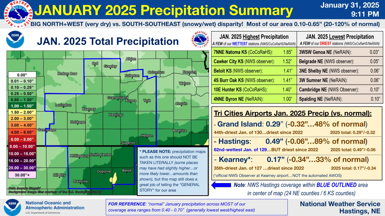
HASTINGS — Precipitation amounts varied greatly across the National Weather Service – Hastings warning area in south central Nebraska and north central Kansas during January.
According to NWS Hastings, areas in their north and west were very dry, while south and southeast saw heavy amounts of snow. Amounts differed between 0.10 inches and 0.65 inches.
The areas that saw the highest precipitation amounts were the Kansas communities, Natoma, Kan., saw 1.65 inches; Cawker City, Kan., 1.52 inches and Beloit, Kan., 1.41 inches. The lone Nebraska community that saw 1.0 inches was Byron.
The driest areas included Genoa, 0.03 inches; Belgrade, 0.05 inches; Shelby, 0.06 inches; Sumner, 0.06 inches; Cambridge, 0.10 inches and Spalding, 0.10 inches.
The Tri-Cities Airports recorded the following last month,
- Grand Island: 0.29 inches, 48 percent of normal, 44th direst January out of 130, direst since 2022
- Hastings: 0.49 inches, 89 percent of normal, 62nd wettest out of 129, driest since 2022
- Kearney: 0.17 inches, 33 percent of normal, 35th driest out of 127, driest since 2022
For reference, normal January precipitation ranges from 0.40 inches to 0.70 inches, generally lower in the west and higher in the east.
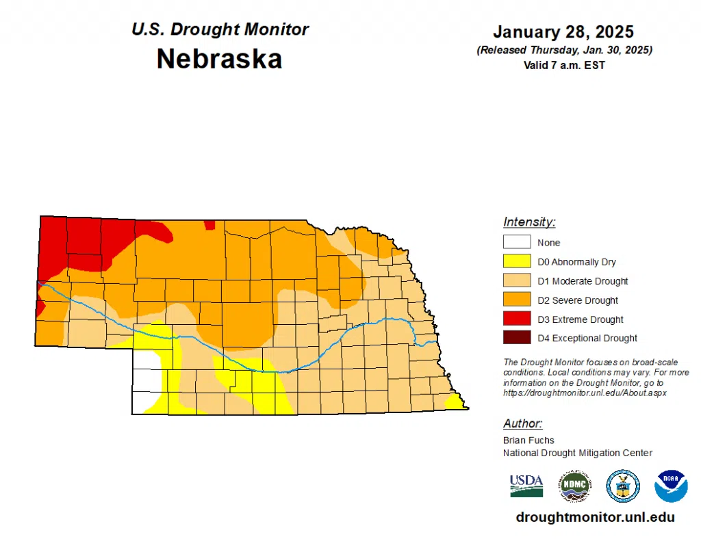
Drought conditions remain in place and are largely unchanged, with most of south-central Nebraska being under moderate drought, D1, conditions. There is a swath of abnormally dry, D0, conditions across Phelps, Gosper and southern parts of Dawson and Buffalo counties.
The most severe drought conditions in the state, extreme drought, D3, conditions are in place across the northern Panhandle.
“In many instances the drought is still considered severe or worse, but where the intensity was reduced, it was due to not all the indicators converging to what was being shown,” the U.S. Drought Monitor stated about drought conditions in High Plains.