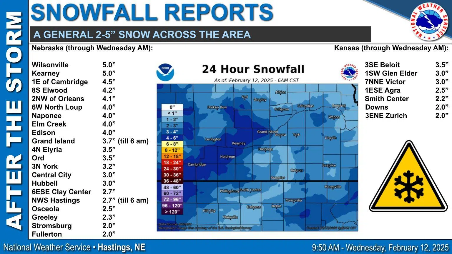
KEARNEY — As snowfall begins to wind down across south central Nebraska, most of the area saw between 2-5 inches over a 24-hour period from Feb. 11-12.
The National Weather Service – Hastings noted that totals were a little less than predicted, especially across north central Kansas. However, a swath from Cambridge to Kearney saw higher amounts of snowfall.
As of 6 a.m., Wednesday, Feb. 12, Kearney and Wilsonville recorded five inches of snow. Other areas that saw locally higher amounts were Cambridge, 4.5 inches; Elwood, 4.2 inches; Orleans, 4.1 inches; North Loup, Naponnee and Elm Creek recorded 4.0 inches.
Grand Island recorded 3.7 inches and the NWS Hastings office measured 2.7 inches.
“Intermediate bursts of light to moderate snow are possible through the rest of the morning with decreasing coverage and intensity between 12 p.m. and 6 p.m. The transition from accumulating snow to flurries will start in our western portion and will move east,” per NWS Hastings.
Many areas will see improving conditions before the expiration of the Winter Weather Advisory and Winter Storm Warning through 6 p.m. as snowfall winds down.