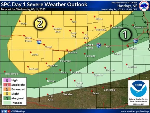
Slight Risk for severe weather issued for Wednesday, May 14, (NWS Hastings, Courtesy)
KEARNEY — A Slight Risk for severe weather has been issued for a swath of the state from the southwest to northeast, including parts of central Nebraska, for the evening of Wednesday, May 14.
The Storm Prediction Center has issued the slight risk, a two out of five, for areas including Kearney, to McCook, North Platte, Broken Bow and areas north of Grand Island.
According to the National Weather Service – Hastings, instability will build this afternoon and thunderstorms are expected to develop late this afternoon along a cold front which will mainly pose a threat for large hail and damaging winds.
Areas near the triple point intersection of the cold front and off the nose of the surface low pressure area could be more discrete in nature and there could be a chance for an isolated tornado.
Thunderstorms will start off discrete and then eventually merge into a line as they move across central Nebraska.
Storm formation farther to the south is less certain given the lack of upper-level forcing, storm development is more certain along the advancing cold front in north central Nebraska.
Showers and storms will lift to the northeast, out of the area by midday Thursday.