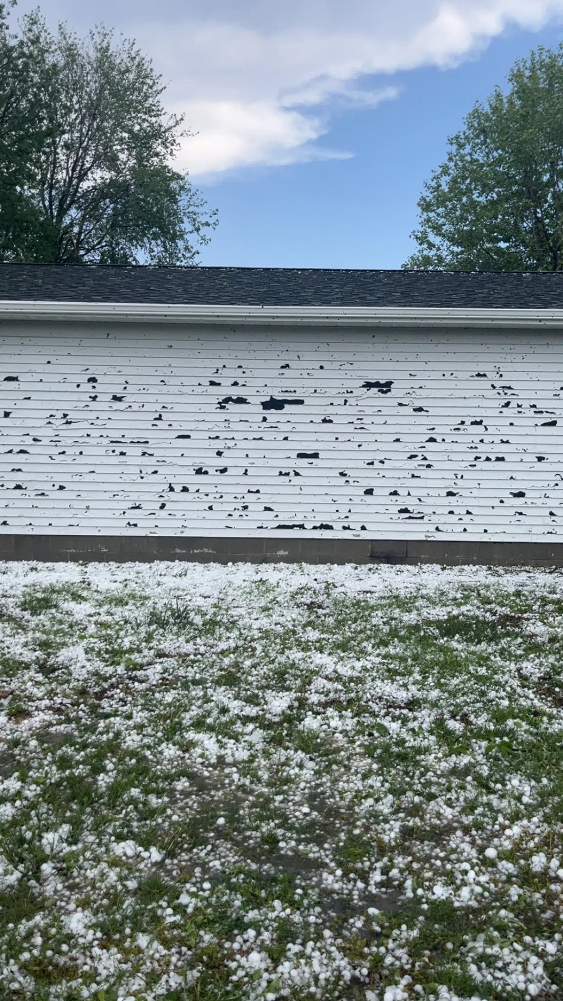
Hail damage to a structure in Edgar during the evening of Monday, May 19, (Amanda Menke, Courtesy)
EDGAR — Hail up to the size of baseballs caused damage in parts of Edgar during the late afternoon hours of Monday, May 19. Additional severe weather took place on Sunday, May 18, along with heavy rainfall.
Mike Moritz, Warning Coordination Meteorologist with the National Weather Service – Hastings, said hail the size of golf balls and baseballs fell in Edgar and caused damage to windows, siding and vehicles that were outside when the storm moved through.
Edgar is a community in southern Clay County with a population around 498.
Other areas that saw notable hail reports included Nance County and Central City.
Mortiz noted that while they had a tornado warning on a storm in Nance County on Monday evening for mid-level rotation, no tornado is suspected to have occurred.
Storms in the area dissipated in the early evening owing to a lack of low-level moisture to draw upon.
Central Nebraska also saw severe weather throughout the evening of Sunday, May 18, but the headline was the rain that parts of the area received.
The highest amounts included Burr Oak, 5.62 inches, Esbon, 5.60 inches, Edgar, 4.78 inches and Oak, 4.63 inches.
Mortiz said that while rainfall was expected, the heavy amounts of five to six inches was “amazing” for area that was impacted.
Throughout Sunday and Monday, Grand Island recorded 1.99 inches, Kearney, 1.63 inches and Hastings, .57 inches.
Mortiz also noted he plans to do a damage survey for a possible tornado near Shickley in Fillmore County.
He also notes there was a brief tornado reported near Elba in Howard County at 12:50 a.m. early Monday morning, but this will likely be rated as EF-U due to lack of damage indicators.
Sunday also saw a cyclical supercell impact southwest Nebraska and would produce at least two tornadoes and up to baseball sized hail.
According to the National Weather Service – Goodland, Kan., a supercell initiated near the Kansas-Colorado border and lifted north into Nebraska.
This storm would produce a strong EF-3 tornado three miles west of Stratton in Hitchcock County. It had peak winds of 140 mph and a length of 10.6 miles. The tornado would lift south of Hamlet.
In addition, straight line wind damage was caused by the same storm with 112 mph estimated southwest of Stratton.
As the supercell moved northeast, according to the National Weather Service – North Platte, a confirmed EF-2 tornado occurred in Hayes County. The maximum winds were estimated to be around 115 mph with damage to a cattle processing lot being the main damage indicators.
The tornado was on the ground for 40 minutes and at its maximum width it was 1,000 yards wide, it would eventually lift in the extreme southern area of Lincoln County.
The same supercell also produced baseball sized hail that fell in parts of Hayes County along its path.
Clay County Thunderstorms